Updated 29 May 2026
The Bayview trail starts at the Bayview trailhead, about seven miles north of South Lake Tahoe on Hwy 89, across the road from Inspiration Point, near Emerald Bay. Two large parking lots are provided; the fee is $10, but is free with a season pass that is also accepted at Pope Beach and at Baldwin Beach (buy the pass for $120 at Pope Beach or Baldwin Beach).
There are several possibilities for hikes, depending on whether one takes the left or the right branch at the trailhead:
- Take the left branch at the trailhead to a trail above Cascade Lake and then to Cascade Falls (1.5 miles round trip, 300 feet elevation gain)
- Take the right branch to a stunning overlook of Emerald Bay (1.5 miles round trip, 500 feet elevation gain)
- Hike to Maggie’s Peak (5.0 miles round trip, 1759 feet elevation gain)
- Hike to Azure Lake (7.4 miles round trip, 2264 feet elevation gain)
- Hike to the “String of Pearls”: Granite Lake, Dick’s Lake, Fontanillis Lake, Upper Velma Lake and Middle Velma Lake (12.0 miles round trip, 2710 feet elevation gain)
A map and some photos are shown below.
If you take the right branch, a Desolation Wilderness day use permit (free) must be completed at the trailhead, and you must keep the top portion with you.
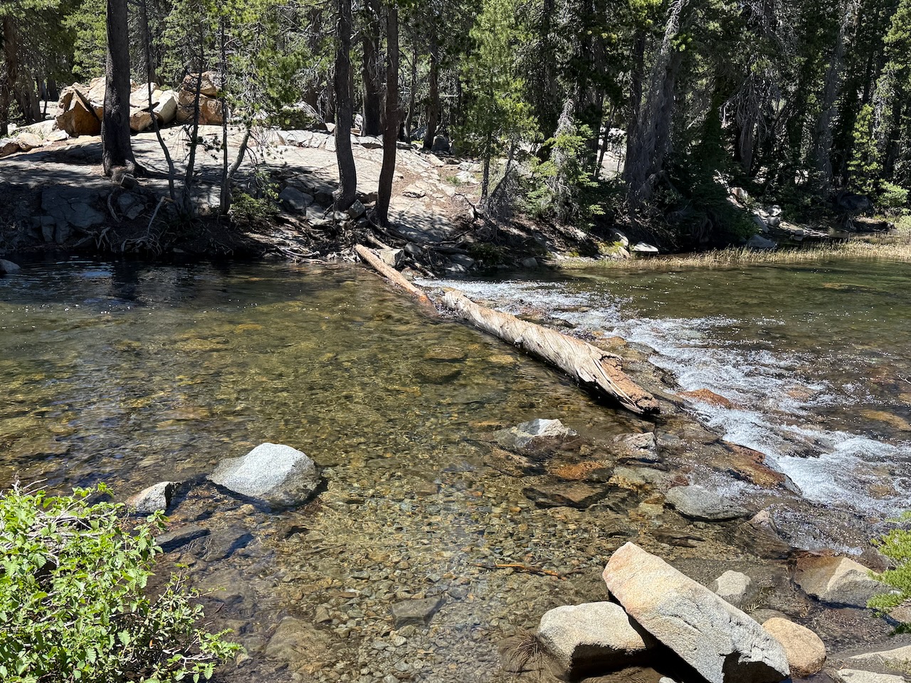
Hike (e), called by locals the “String of Pearls”, is one of the most spectacular in the region, visiting numerous lakes, streams and breathtaking vistas. But be advised that this is not a casual afternoon hike with flip-flops: It is 12.0 miles round trip, with 2710 feet total elevation gain. Thus hiking boots, poles and a knapsack are strongly recommended. During any month other than late summer, be prepared to encounter patches of snow, and there are two stream crossings that require either wading with bare feet or walking on logs with hiking poles.
Note for Maggie’s Peak: The unmarked and obscure turnoff to Maggie’s Peak is at N38 56.070 W120 06.894; use a GPS to find this!
Note for Azure Lake: The unmarked and obscure turnoff to Azure Lake is at N38 55.789 W120 07.261; use a GPS to find this!
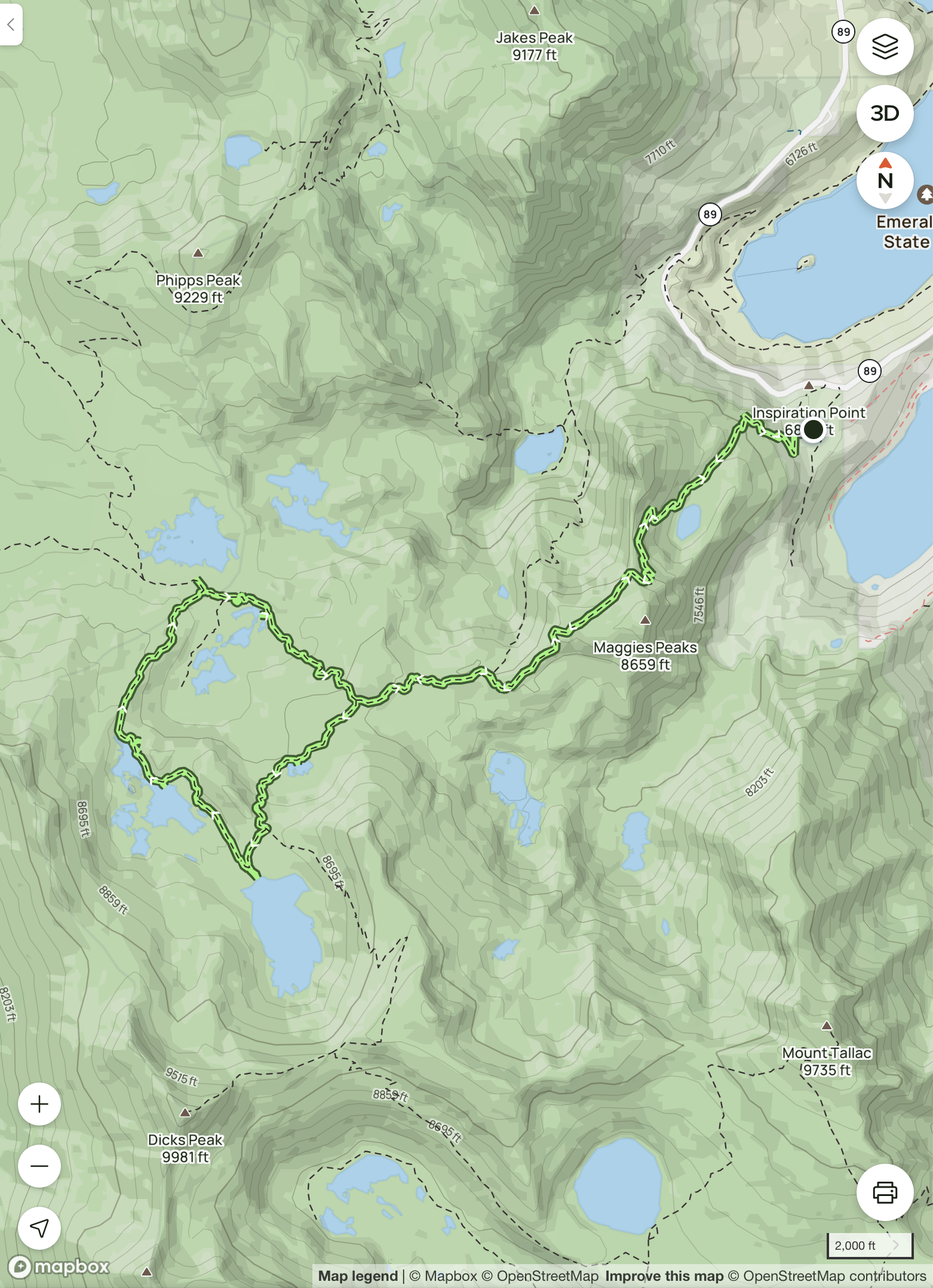
Here is a map of hike (e), the “String of Pearls”: ascend to the Emerald Bay overlook, then to Granite lake, then to Dick’s Lake, Fontanillis Lake, Middle Velma Lake and Upper Velma Lake, before returning:
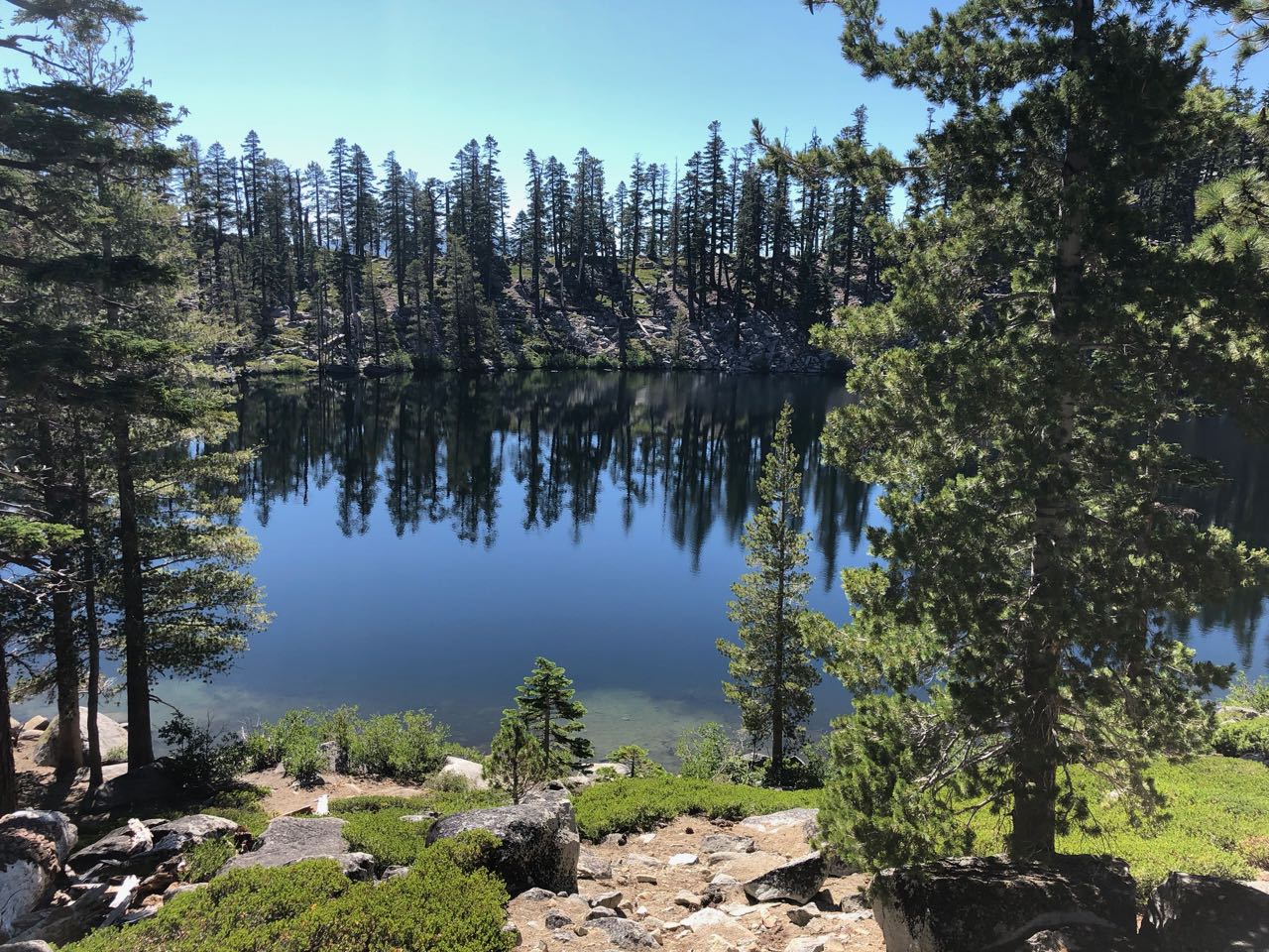
Here is Cascade Lake, which is on the left branch of the trail from the trailhead:
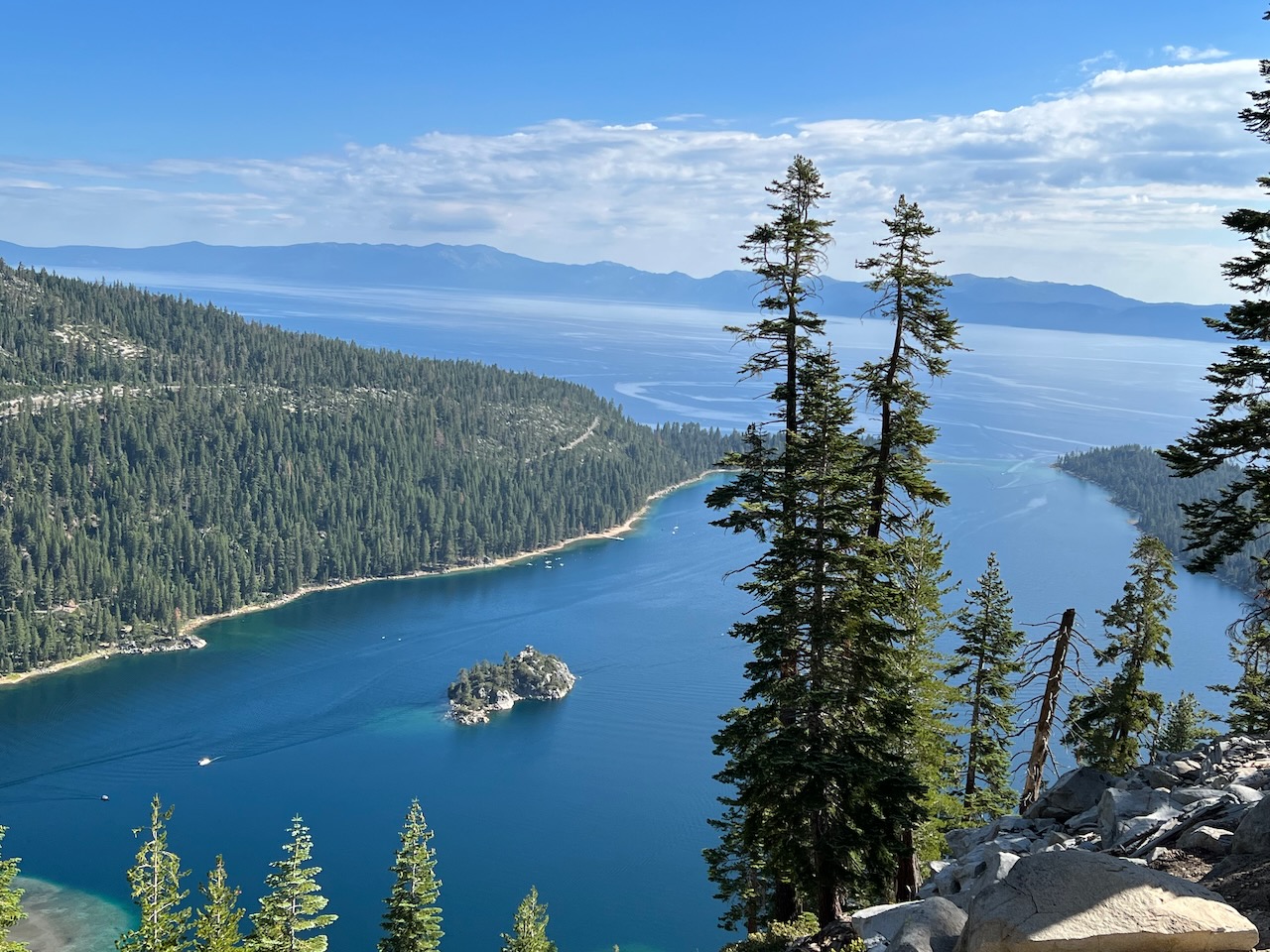
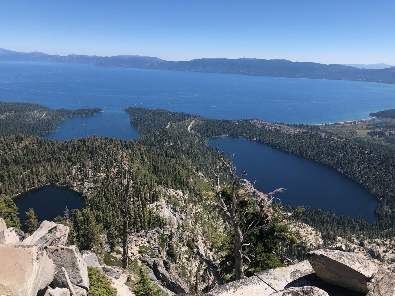
Here is the Emerald Bay overlook, on the right branch of trail. It is every bit as stunning as it appears here:
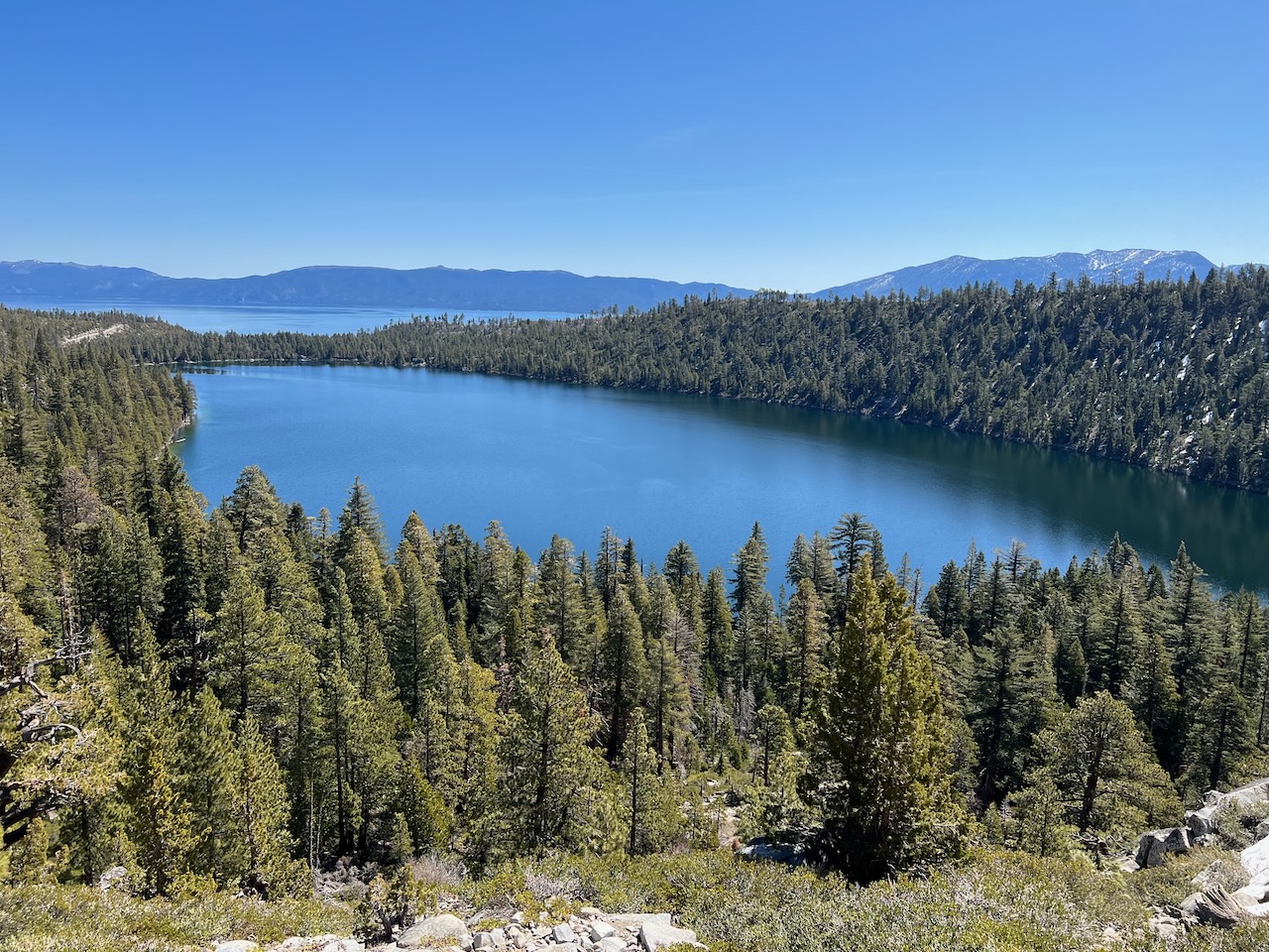
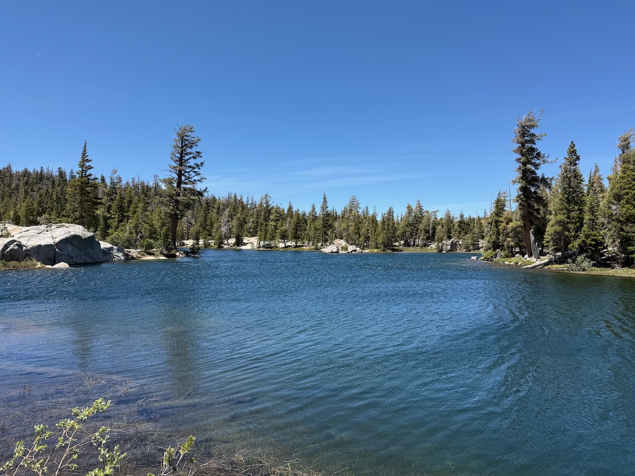
Granite Lake, just two miles up on the right branch of the trail, is a popular family backpacking spot (a wilderness permit is required for overnight stay):
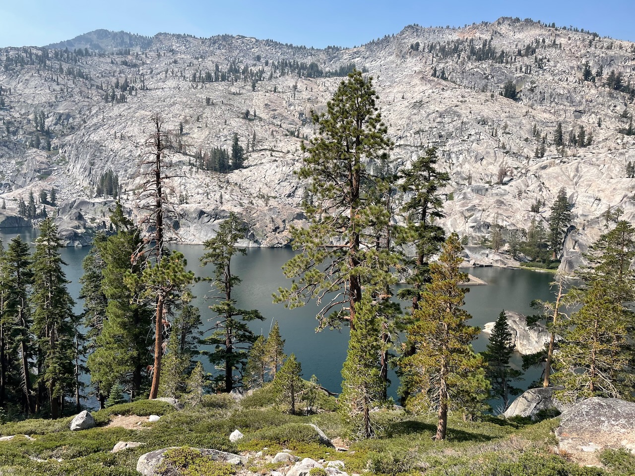
The view from top of Maggie’s Peak is almost as sweeping as from Mt. Tallac. Emerald Bay, Granite Lake and Cascade Lake are clearly visible, with Lake Tahoe in the background:
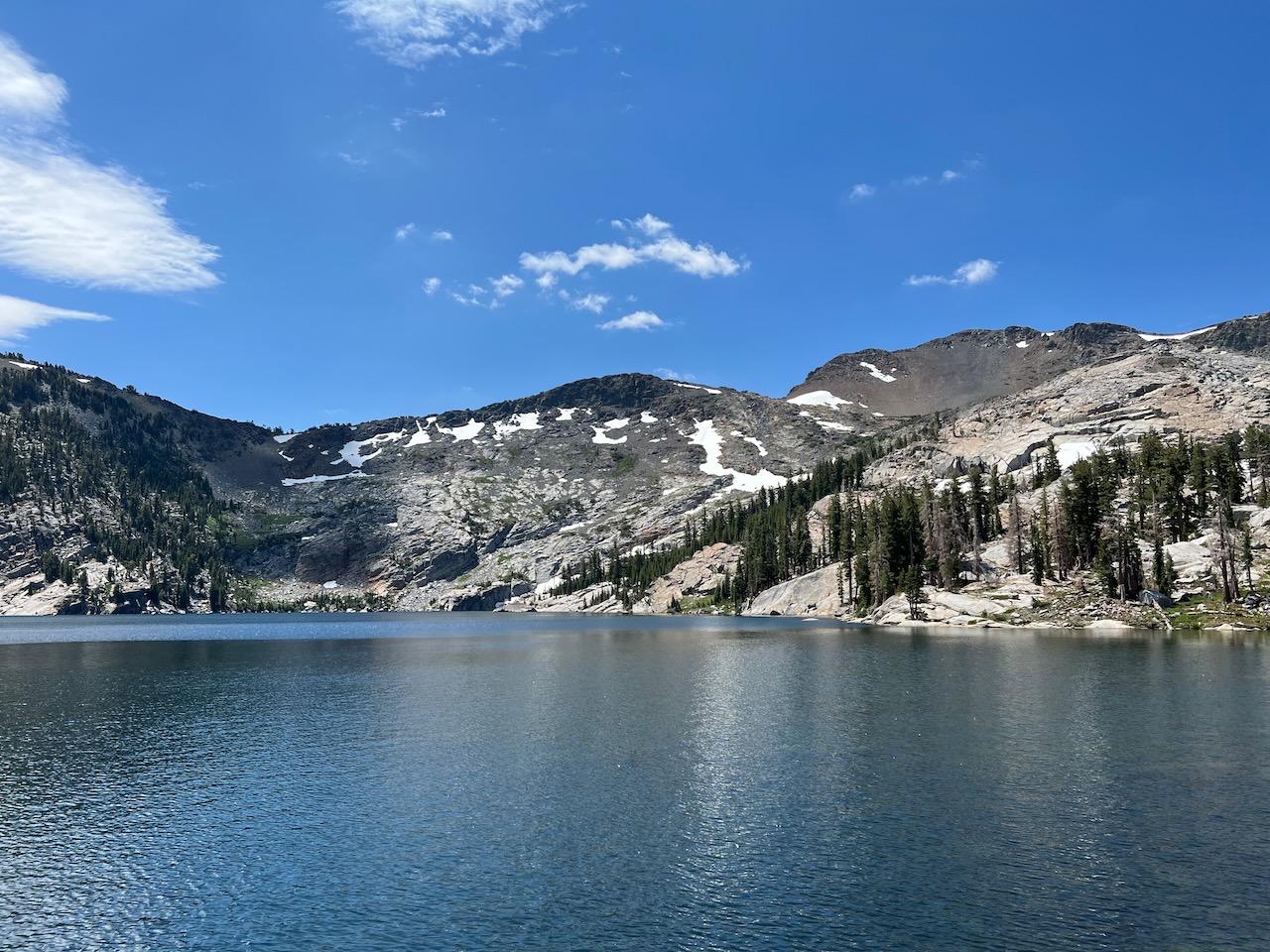
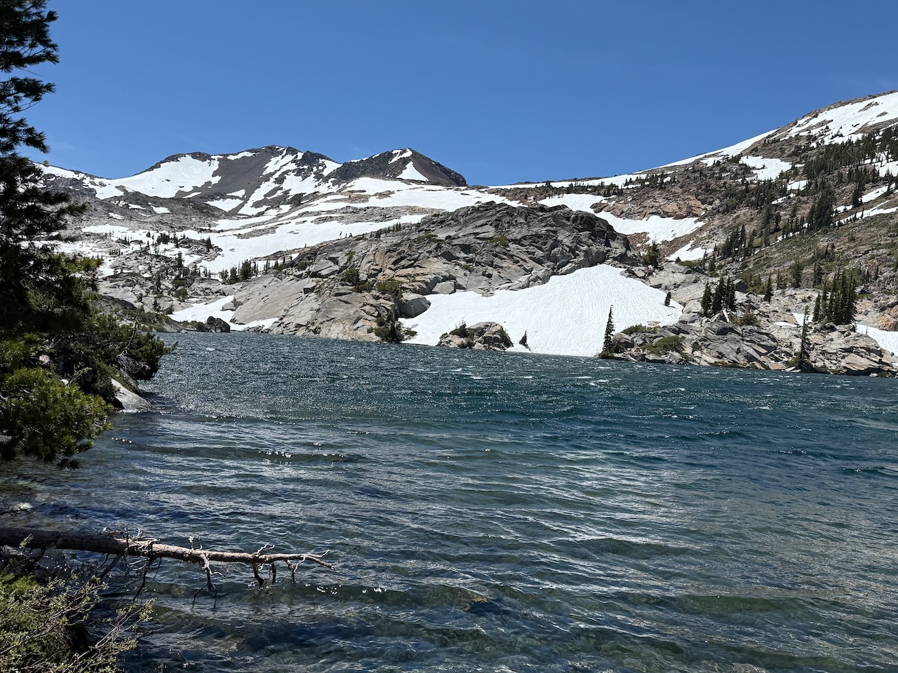
This is Azure Lake:
Here is Dick’s Lake:
Fontanillis Lake:
Upper Velma Lake:
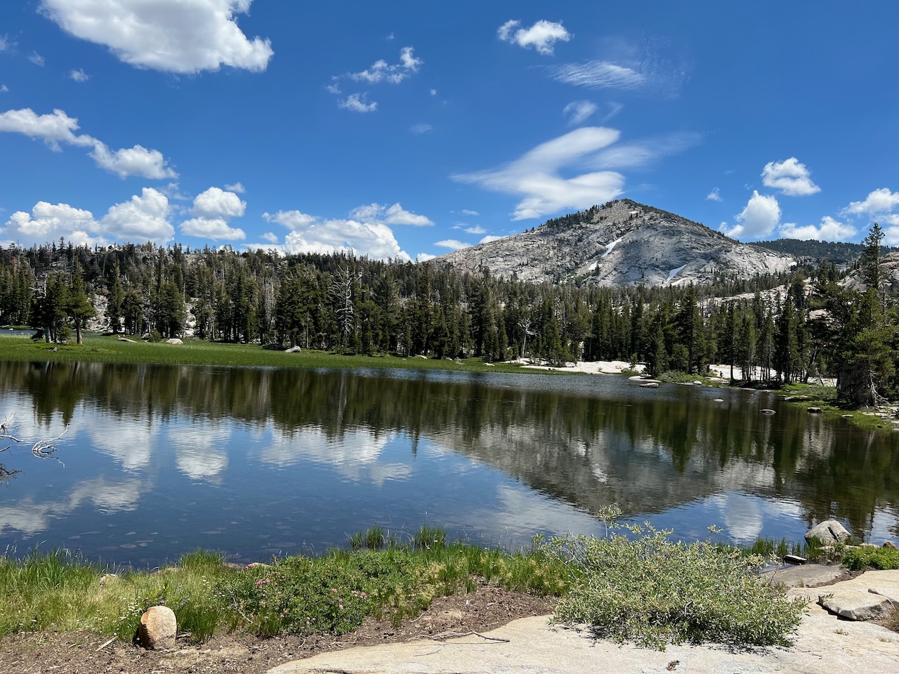
Another section of Upper Velma Lake:
One stream that must be crossed by wading: