Updated 29 July 2025
The Meiss Lake trail starts from a trailhead approximately 0.25 miles west of Carson Pass on Hwy 88, about 20 miles south of South Lake Tahoe. From here the trail (part of the Pacific Crest Trail) ascends north to a saddle summit, then descends to a very lovely large valley (Meiss Meadow), which is the headwaters of the Upper Truckee River. The trail continues past Meiss Lake (about 0.5 miles to the right), and then ascends about 400 feet to Showers Lake. Both Showers Lake and Meiss Lake are among the loveliest in the region. There are several possibilities, including:
- Hike on the Pacific Crest trail to Showers Lake and return (9.2 miles round trip, 1600 feet elevation gain)
- Hike along the Skyline Ridge to Showers Lake, then return via Meiss Meadows (10.4 miles round trip, 1916 feet elevation gain); see discussion below
- Hike to Meiss Lake (10.4 miles round trip, 1200 feet elevation gain); see discussion below
A map and some photos are shown below.
My favorite hike is (b). To hike this trail, one must take a hard-to-spot left turn at the saddle summit, just before the small pond, at N38 42.262 W120 00.215 (take a GPS to find this the first time). This trail, variously named the Skyline Ridge trail or Showers Ridge trail, ascends the ridge and continues along the spine, with glorious views, before dropping to Showers Lake. Taking the standard Pacific Crest Trail back to the trailhead, through the valley, makes a nice and very scenic loop.
The best way to reach Meiss Lake (c) is to take the Pacific Crest Trail from the trailhead north over the saddle to the junction with the Tahoe Rim Trail, at N38 43.367 W120 00.729, then turn right on the Tahoe Rim Trail for approximately one mile to the point N38 43.862 W120 00.416 (totally unmarked — use a GPS). Then turn northwest and hike cross-country about 0.3 miles to the point N38 44.042 W120 00.704, which is on a rock overlooking the lake — a truly gorgeous spot.
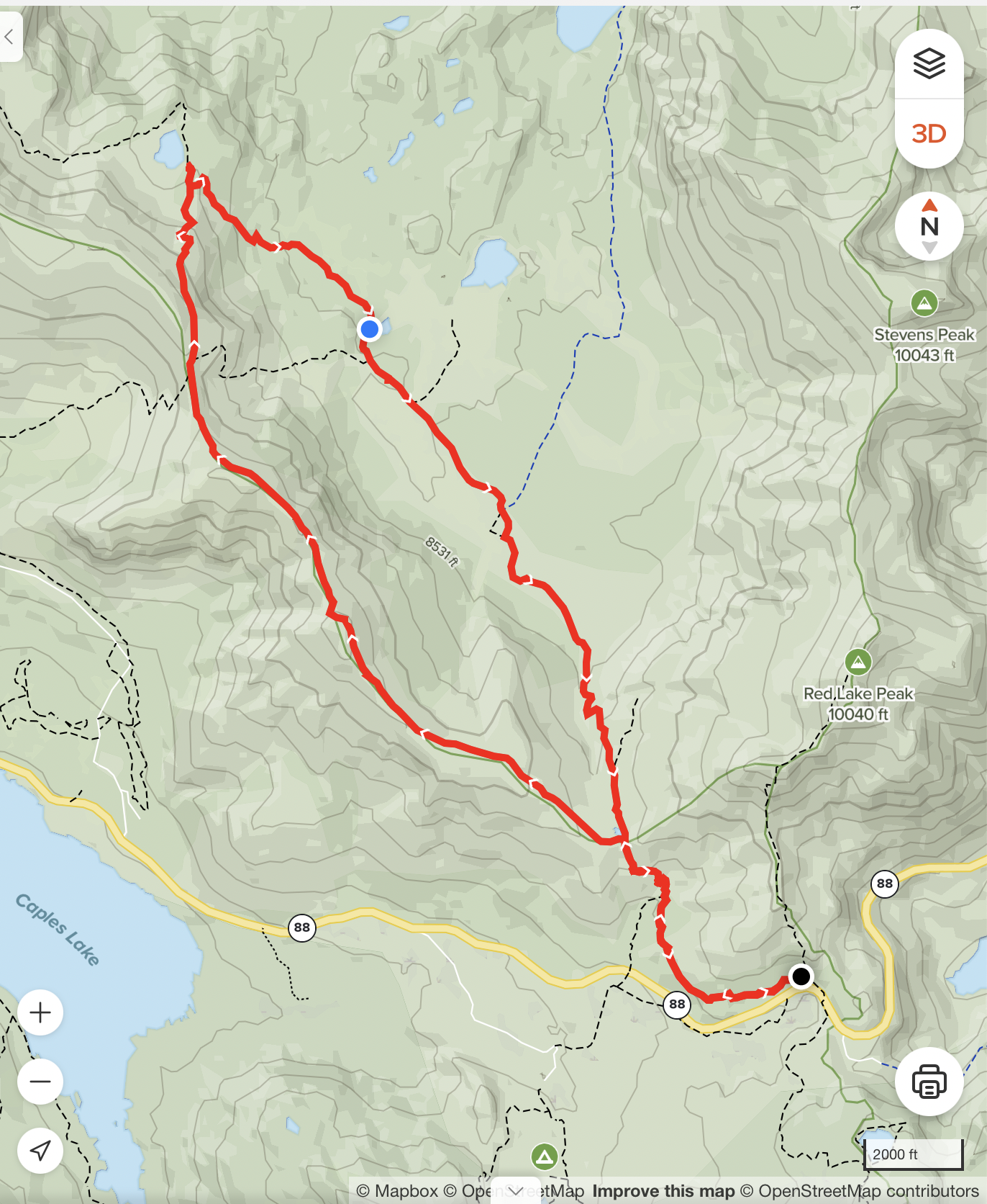
Here is a map of the hike (b) from the Meiss Lake trailhead to the saddle summit, then along Showers Ridge to Showers Lake, then back along the Pacific Crest Trail through Meiss Meadow, and returning to the trailhead, as described above:
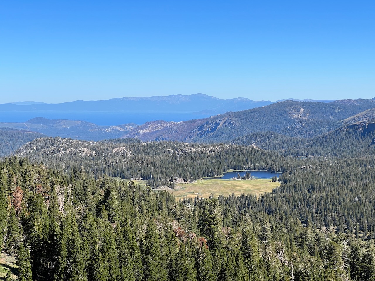
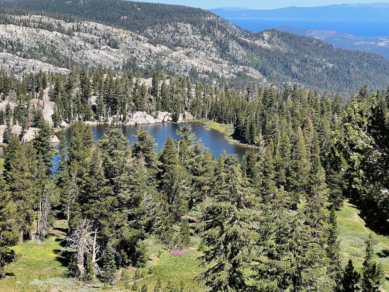
Here is a photo taken from Showers Ridge, looking north to Meiss Lake with Lake Tahoe in the background:
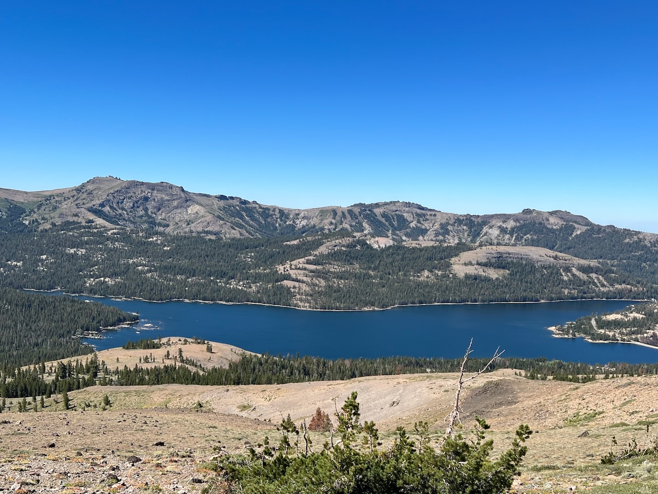
This is Cappels Lake, looking to the west from the ridge:
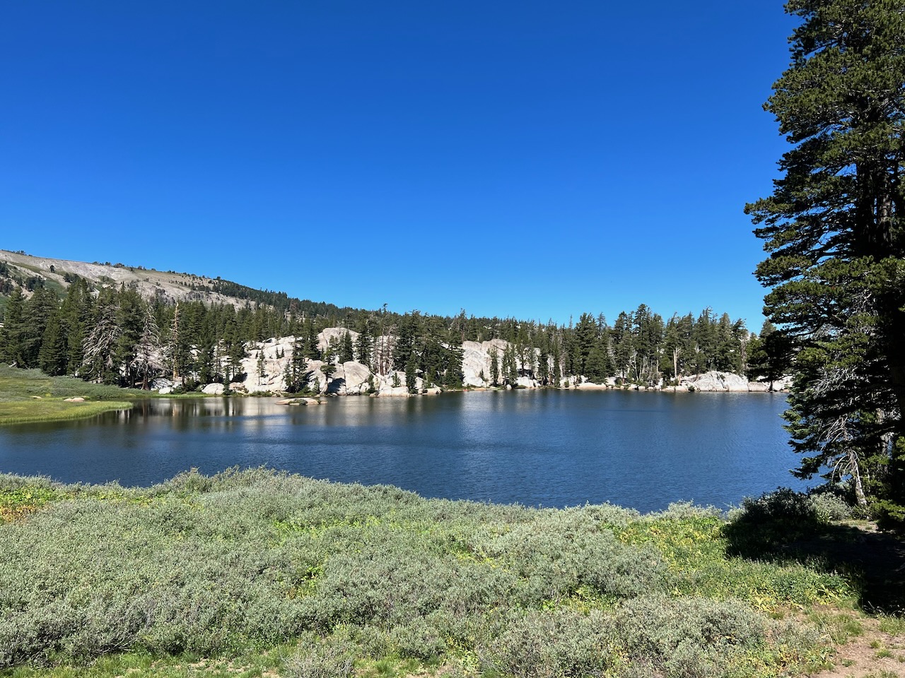
Here is Showers Lake from the ridge (note Lake Tahoe in the background):
This is Showers Lake up close:
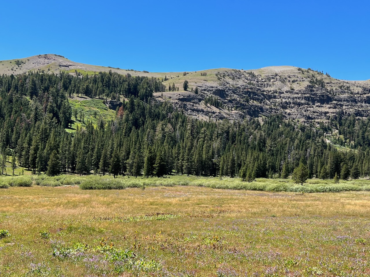
Here is a photo from Meiss Meadow, looking west to Showers Ridge:
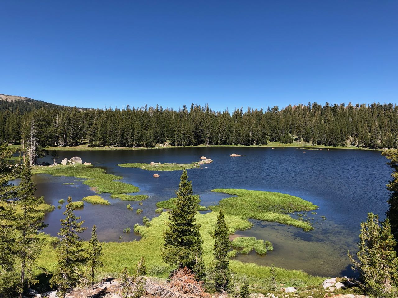
This is Meiss Lake, a truly lovely sight: